Amman valley river walk
The Amman and Loughor valleys are two of the westernmost valleys in the historic South Wales coalfield. During the 19th and 20th centuries they were transformed from quiet, rural countryside into busy industrial valleys, with the rapid growth of the anthracite coal industry. But the story of these valleys reaches far back into prehistoric times. Ancient burial sites, dating back over 3000 years to the Bronze Age are found on local hills, and there is even evidence of the presence of early humans from bone caves in the Llandybie area. The Amman valley has been identified as Amanwy, the scene of the mythical chase of the magical boar, the Twrch Trwyth, by King Arthur and his warriors in the ancient Welsh tales of the Mabinogion. In medieval times, these valleys were the frontier between the Welsh princes of Deheubarth and the Norman lords of the Gower. Later, they became the border between the historic counties of Carmarthenshire and Glamorganshire.
The route includes woodland, farmland, river pools and wiers and abundant wildlife along its length. There is much to see with birds overhead, including buzzards and the occasional red kites, wildlife and livestock. A shaky suspension bridge provides a spectacular river view and excitement for all and there is an abundance of wildflowers along the riverbank, so why not take your time and enjoy the experience to the full.
A range of shops, cafes and inns can be found in the villages and towns of the area. Look out also for the Amman & Loughor Heritage Walks panels located in the main villages, which tell you much more about the history of the area.
Why Walk?
This popular route from Brynamman to Ammanford closely follows the River Amman. The route is used by walkers and cyclists, passing through woodlands, leafy lanes and parkland. The villages in the Amman Valley owe their expansion to the industrial revolution of the 19th century. Few obvious signs of this industrial age are to be found now, the spoil heaps and industrial sites have been re-landscaped and returned to woodland and farmland. There are shops, pubs and cafes in the villages along the way. Each village has heritage information panels highlighting the history and wildlife in each area.
How Long?
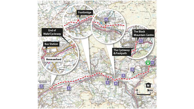
This linear route is just under 9km long (5½ miles) and descends 154m (505 ft) with only 23m (75 ft) of ascent.
How Hard?
The route is surfaced throughout and is ideal for family groups, or people with mobility problems. The route can be easily accessed from each village along the way and therefore split into several sections to be completed in stages.
Starting point - The start of the walk is off Station Rd, at the cycleway. Turn right off station road and pass the rugby ground to the tarmacked path alongside the river Amman.
Car Park - Black Mountain Centre in Upper Brynamman and also in Ammanford
Public Transport - ✔ Refreshments - ✔
Amman valley riverside walk
Points of Interest
1. Brynamman stands on the very edge of the Black Mountain and the Brecon Beacons National park. Coal and Iron ore were available locally which led to the construction of two blast furnaces to smelt iron, a tin plate works, a brick factory, a railway line and a station – now all gone.
2. Off the cycleway on the opposite side of the River Amman is Ynys Dawela Nature Park accessed over a narrow footbridge. Once the site of a coal mine it is now an area of woodland and flower rich meadows.
3. The river and its banks are important habitats for wildlife. Its possible to see a variety of water birds, Mergansers, King Fishers, Mallards, Dippers and Wagtails.
4. You briefly enter Neath and Port Talbot County before crossing two roads to arrive in Garnant. At the confluence of the Cwm Garnant river and the river Amman is a small car park with a seating area where The Palais Cinema once stood.
5. From the Palais site cross the river into parkland.
6. Pass the narrow suspension bridge (which provides access to the main road) and enter a more wooded section of the walk down to Pontamman and the road into Ammanford town centre.
7. By 1911 Ammanford was a thriving industrial settlement, in all respects the capitol of the Carmarthenshire coal field. Legend has it that King Arthur and his knights hunted wild boar on the slopes of the Amman Valley, that is why the Wild Boar is featured on historical trail boards and great metal sculptures about Ammanford.
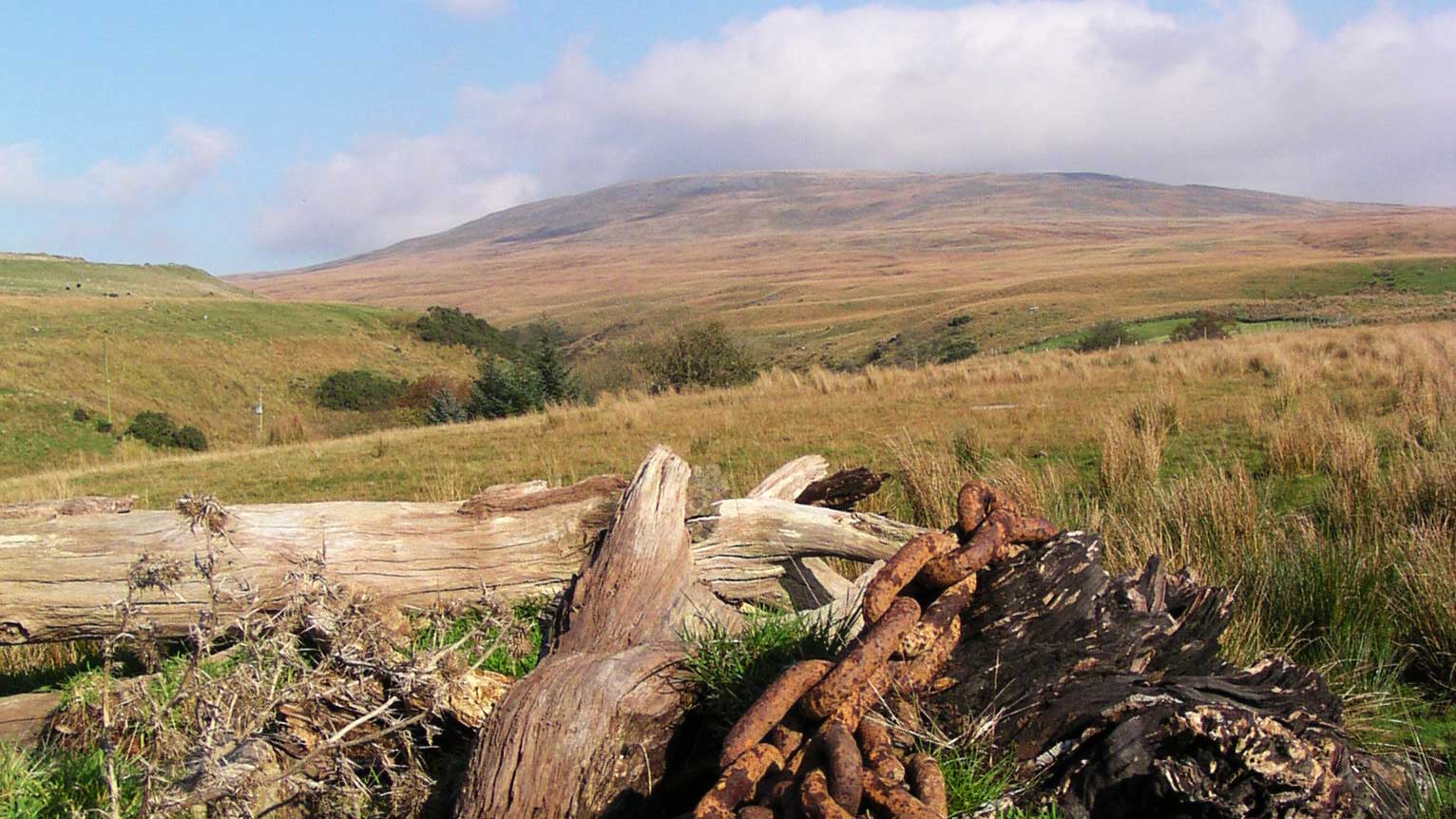
Black Mountain
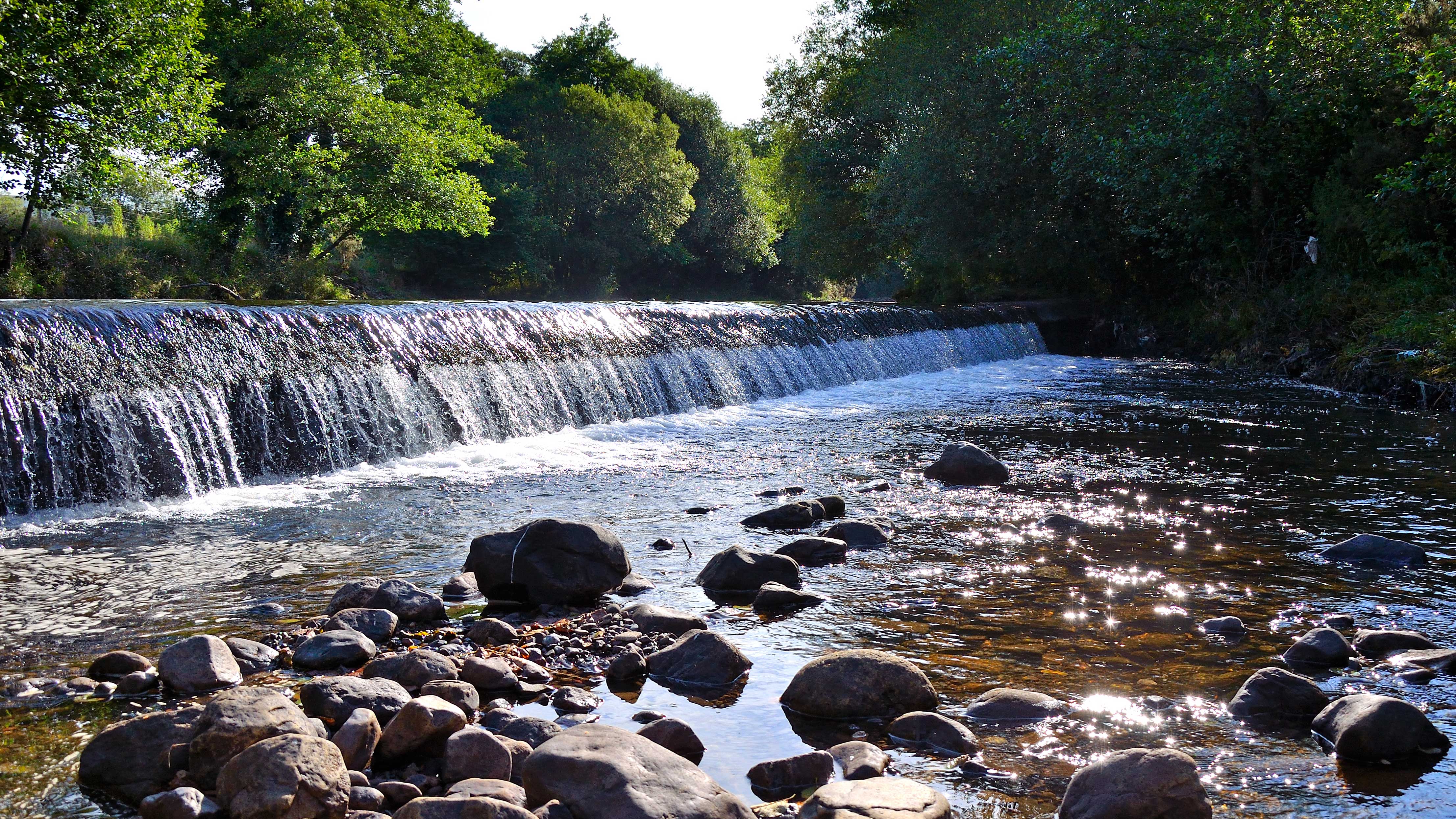
River Amman