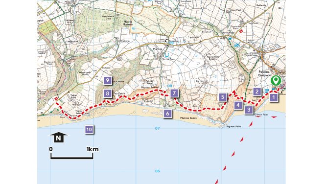
Pendine to Amroth
Pendine to Amroth - Wales Coast Path
Between Pendine and Amroth, with their throngs of summer visitors, lies an isolated coastline of rugged beauty with a wealth of natural and historical interest.
To our Stone Age ancestors, this section of coastline would be virtually unrecognisable. During the last Ice Age, the glaciers advanced south, to a line just short of Pendine. Looking north the land lay under a deep cover of ice, whilst to the south, what is now Carmarthen Bay was dry land.
The remains of peat beds that can be found below the present-day high tide level have been radiocarbon dated to around 3000BC and tell of a time when the bay was marshy ground cloaked by a forest of alder and oak.
At this time Neolithic peoples lived in the area and left their mark in the form of stone chambered tombs. Later Bronze Age remains include ritual burial monuments such as barrows and ring cairns. More impressive earthworks were left by Iron Age communities who built hill forts at Top Castle and Gilman Point. They are promontory hillforts (a type common to the west coast of Wales) situated on naturally defensible positions where the land drops away steeply on three sides.
The mediaeval settlement at Pendine was inland and uphill of the present-day beach resort, centred on the Parish church. Relic field boundaries dating back to this time can still be seen on the slopes leading down to Marros beach. Unfortunately, many others, some of which may have been Bonze Age, were destroyed in the 1980s.
Pendine emerged as a holiday resort from the mid-18th century onwards when there was a growing interest in sea bathing as a health cure. The long period of the Napoleonic Wars forced many of the well-to-do to travel within England and Wales and this gave a boost to the seaside resorts.
Why Walk?
A linear route with sometimes challenging walking along a very attractive stretch of Carmarthen bay and the Wales Coast Path.
How Long?
The route is approx. 8.5km long (5.3 miles) with 374m (1,227ft) of ascent.
How Hard?
There are some very steep sections which some walkers may find difficult, and the path follows rough grassy tracks for much of the way. There are shops, pubs and cafes in the villages at both ends of the walk but none in between and no shelter. Walkers need to wear appropriate footwear and clothing.
Starting point - Car Park, Pendine
Public Transport - ✔
Refreshments – ✔
Video for the Pendine to Amroth walk
Points of Interest
1. The stunning view along the coast and countryside is a fitting reward for the strenuous climb to the top of the hill.
2. In summer, the bright yellow flowers of ragwort are easy to spot alongside the path, a plant poisonous to both horses and cattle, but the food plant of the yellow and black Cinnabar moth caterpillars which become poisonous to birds which soon learn to ignore them.
3. The defensive banks and ditches of an Iron Age hillfort can still be seen at Gilman Point. A gang of smugglers once lived near here and used the caves in the area to store their contraband goods.
4. The battered slab of concrete at the mouth of Morfa Bychan valley was built for a secret Second World War training exercise, code named "Exercise Jantzen". Troops in landing craft and tanks stormed the beach in practise for the Normandy landings.
5. "When gorse is in flower kissing is in season" is a romantic saying known throughout Britain. Common Gorse and Western Gorse often grow together, between them they flower throughout the year. Gorse was used to heat bread ovens, milled to make fodder for horses, the flowers collected as confetti or boiled to make a medicine to ease the pains of tonsillitis.
6.The 5000 year old peat beds on Marros beach form part of a Site of Special Scientific Interest. Please take care not to damage them.
7.The remains of a wall built from beach pebbles and an overgrown mill pond is all that now remains of Marros Mill, mentioned in an estate survey dating back to 1307.
8. At Top Castle are the extensive remains of an Iron Age hillfort.
9. Teagues Wood - Local legend has it that Teagues Wood was the place where the last wild wolf in Wales was killed.
10. Carmarthen Bay is recognised as one of the most important sites in Britain for Common Scoter, a type of sea duck, that can be seen from late summer and through the winter before leaving for their breeding grounds in Scandinavia and Russia.
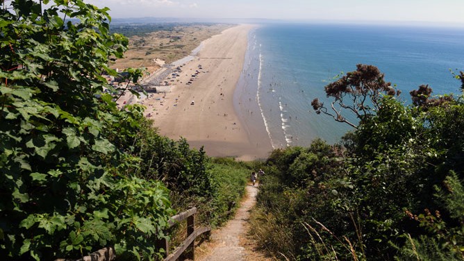
View from the Coast path overlooking Pendine
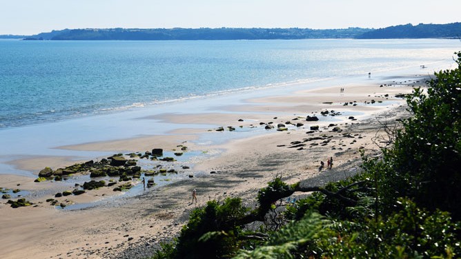
Telpyn point