Swiss Valley
Swiss Valley Path – Llanelli to Cross Hands (Sustrans Route 47) 14miles approx.
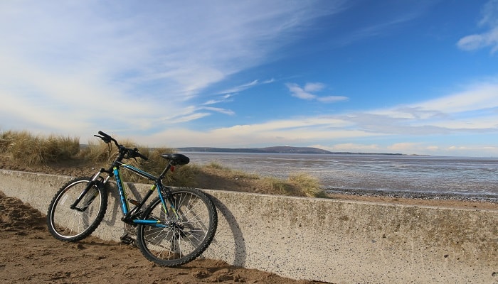
This fantastic off-road path follows the route of the historic Llanelli and Mynydd Mawr Mineral Railway through the beautiful countryside of the Gwendraeth Valley. It is mostly flat, with a tarmac surface and easily accessible.
It climbs gently at a slight gradient from Sandy Water Park Llanelli to Cynheidre, passing the beautiful Lliedi reservoirs at Swiss Valley. The path then runs flat along the top giving wonderful views of the Gwendraeth Valley as it winds its way through Mynydd Mawr Woodland Park.
All traces of the former coal industry have gone save for a few locations where its memory has been preserved.
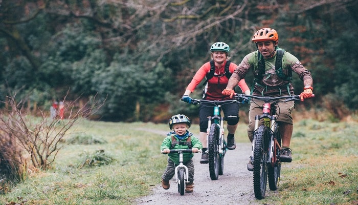
Travel this route in easy stages and enjoy remarkable scenery, farm animals and wildlife with Buzzards and the occasional Red Kites circling overhead.
Parking: North Dock and Sandy Water Park in Llanelli, Tumble and Cross Hands.
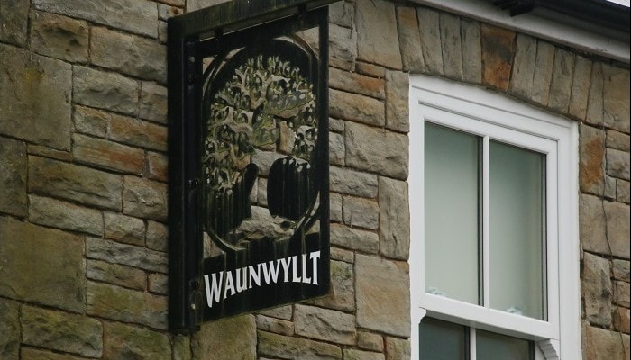
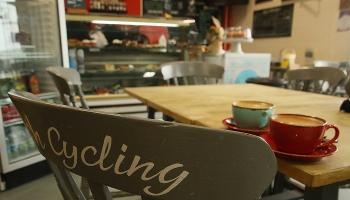
Refreshments / toilets: The Discovery Centre at North Dock in Llanelli, The Waun Wyllt Inn at Horeb, Tumble and Cross Hands.
Highlights: There is so much to see and do along the way, with wildlife, places of interest, viewpoints and refreshment stops, so why not take your time and enjoy the experience to the full.
For families especially, but also those who prefer a more gentle pace, the route has been divided into three self-contained sections below including advice on how to get there and what to see and do. You can of course start at either end or combine sections.
Llanelli to Horeb
Llanelli to Horeb (10 mile round trip)
North Dock or Sandy Water Park are convenient starting points for this trip crossing over the Blue and White Pont D'Agen and taking the NCN 47 route. This bridge also links with Llanelli town centre, an alternative starting point. It’s a good idea to travel this way out as the return trip is a delightful downhill gradient requiring little effort.
The route passes through Furnace with its pubs and shop, continuing through Pentrepoeth and above Felinfoel, home of the famous brewery. After another ½ mile, the path passes above the delightful Lliedi reservoirs at Swiss Valley. There are plenty of places to stop, sit, have a picnic and enjoy the view. You can descend the steep path to walk around the reservoirs, but it is not suitable for bikes, which would best be left on the path.
The route continues for a mile through woodland, past the ruins of the former Horeb Brickworks, now a listed monument, and opens out at the former Horeb Station, and nearby pub the Waun Wyllt Inn and former Chapel. If you leave the path here and travel west for a mile there is the village of Five Roads and The Stag pub.
Getting there: Services X12, 195 and 196 run between Carmarthen and Llanelli and between Swansea and Llanelli. There is a frequent train service from Swansea and Carmarthen to Llanelli. The bus station is about ¼ mile from the route and the railway station ¼ mile from the trail at Seaside, near North Dock.
There is car parking at North Dock and Sandy Water Park in Llanelli, but only on the road at Horeb unless you ask at the pub.
Horeb to Tumble
Horeb to Tumble (11 mile round trip)
The route gently climbs beyond Horeb for a mile to Cynheidre then running level through farm fields and woodland for 4½ miles to Tumble. From Cynheidre you can enjoy fantastic views of the Gwendraeth Valley and further afield to Pembrokeshire and the Bristol Channel on a clear day.
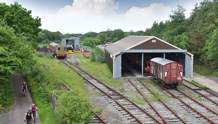
There were coal mines all along this mineral railway and at Cynheidre the four shafts were closed and replaced in the 70s by a drift mine that was mothballed having never been used. The developing Llanelli and Mynydd Mawr Railway Heritage Centre at Cynheidre now includes a picnic area, laid track and repair sheds with regular open days held at what some say is the first mineral railway in the UK.
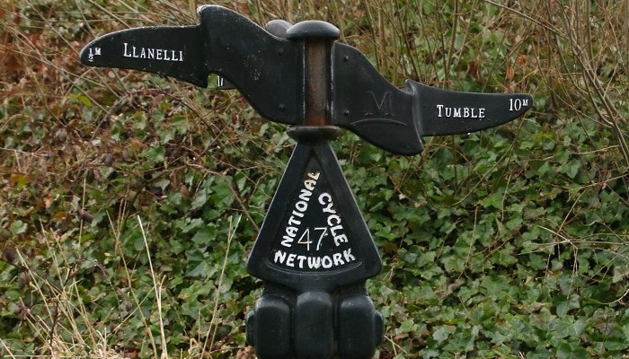
The route continues along this beautiful but remote location to Tumble. Here you need to cross the High Street with all facilities nearby, and the route continues northwards on the other side of the road to Cross Hands. Alongside the track is a Sustrans Dudgeon Milepost with the very appropriate poem Tracks cast in it, and translated into Welsh on a slate plaque at the base, well worth a stop to read.
Getting there: Services 196,166,128,164 run between Llanelli and Cross Hands via the Gwendraeth Valley, but this elevated route is fairly inaccessible by public transport, and careful planning is required.
There is on-road car parking at Horeb or you can ask at the pub. At Tumble there is on-road parking along the trail and at the Great Mountain Club where the trail crosses the B4310 (ask at the club). You can also park on-road at Cynheidre where there is access to the path.
Facilities: At Horeb, there is the nearby Waun Wyllt Inn, or travel along the quiet road for a mile to Five Roads, where there is The Stag pub. For refreshments at Tumble there is the Great Mountain Club, as well as various shops and takeaway food outlets.
Tumble to Crosshands
Tumble to Cross Hands (7 mile return trip)
From Tumble, the path continues alongside the Mynydd Mawr Country Park and with its elevated position has spectacular views of the Gwendraeth Valley and further afield to Pembrokeshire and the Bristol Channel on a clear day; then passing through woodland to Garreg Hollt and Cross Hands. A slight diversion of a few yards at Garreg Hollt (opposite the playing fields) reveals the stone alongside the track that gave the village its name (translated Split Stone). Owain Glyndwr is rumoured to have struck it with his sword in a fit of anger. The route continues to the main road and turning east along it for ½ mile brings you into the centre of Cross Hands.
Getting there: Services 196,166,128,164 run between Llanelli and Cross Hands through the Gwendraeth Valley. At Tumble there is on-road parking along the trail and at the Great Mountain Club where the trail crosses the B4310 (ask at the club). There is ample parking at Cross Hands.
Facilities: At Tumble there is the Great Mountain Club, as well as various shops and takeaway food outlets. At Cross Hands there are a number of shops, takeaway food outlets, and a cycle shop.
Swiss Valley
Start: Sandy Water Park Llanelli, or Cefneithin Rugby Club ground near Cross Hands.
Total Length: 19km or 12 miles
Difficulty Rating: Ungraded but would be green easy if graded.
Total Time: Around 2 hours each way.