Big Hills & Big Views
An epic route that will take you from the industrial heart of Carmarthenshire into the quieter landscapes and over the Black Mountain.
Highlights
Y Mynydd Ddu / Black Mountain – An incredible climb as it twists up the Sawdde valley and onto open ground with far reaching views if you are lucky.
Mynydd Betws / Betws Mountain Climb – A quiet, almost hidden road that sneaks up with a feeling that it has been dug into the mountain as you climb onto Betws Mountain.
Gwrhyd Road Climb – A climb that will test even the fittest and fastest of riders. Very steep and unrelenting. The reward at the top is fantastic views and a great ride along the ridge.
Start: Ammanford
Total Distance: 101km/62 miles
Total Elevation: 2000m/6560ft
Difficulty Rating: 9/10
Estimated Time: 5 to 9 hours
Starting from Ammanford car park, head to Wind Street (A483) and at the centre of town at the lights head to the right onto High Street. After a few hundred meters turn left onto Wern-Ddu Road and follow for 9km.
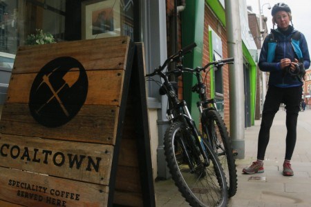
Ammanford and the whole Amman valley is an area with direct links to the industrial revolution as the valley was mined for coal and still shows signs of its history within the town and the entire valley. Local start-up company Coaltown, a rapidly expanding coffee roasters based in the town are just one company paying homage to the history within the area.
Cycling might not be the first thing that would come to mind for people who know the town, but the hills surrounding the valley are filled with cycling gold, not just coal as was once the case. Our route passes through the town centre and within a kilometre we turn left onto Wern Ddu road and start the first climb of the day. It sets the scene for the ride ahead and while Wern Ddu itself is not too severe, with barely a chance to spin the pedals it packs a punch. From the top the views already start to open up with even a relatively modest amount of climbing done. The views mostly towards the south show how built up and urban the area is, but this route heads north and towards the quieter areas of Carmarthenshire.


As you enter the village of Derwydd turn right onto Heol Pen Storom and follow up the hill and to Ffairfach. Turn right at the T-junction and continue through Ffairfach and into Llandeilo. At the roundabout head straight onto the A40 and almost immediate left onto the B4302 (Talley Road).
A few kilometres of undulating roads towards Derwydd and a sharp right hand turn gives a clear view of the next climb. The road must be an old roman road as it is straight as a die and looks ominous, but is actually far easier when attempting it. The view from the top overlooking the town of Llandeilo is fantastic with the famous multi coloured houses that line the hill up Bridge Street clear to see. The descent takes you to the edge of Ffairfach and it isn't long before you are riding up that very street, although it is a savage little climb making it more difficult to enjoy the surroundings as you ride up. Llandeilo is a town filled with fantastic shops and places to eat and a few also on the outskirts including The Hangout, which has recently been voted as having the best coffee in Wales. It is just a short detour off the route, soon after the fast descent from the town centre on the edge of the urban area.
Continue through Talley and at 31km into the route, turn right at a crossroads before the village of Crug-y-bar. Continue uphill, join the A482 turning right and follow for 2km, then turn left onto a minor road signposted Porthyrhyd. Continue through Porthyrhyd and follow the road and signs for Llandovery.
As we climb out of Llandeilo and onto the rollercoaster road that leads to Talley village and beyond. The terrain never feels flat, with a few short, sharp climbs as well as the more gradual drags that make you feel like you are going backwards. The twisting road passes through Talley and on towards Crugybar where we turn right at a crossroads and start a longer climb but one that usually has the wind behind you and we will take all the help we can.
A short but fast section on the A482 before peeling off left and onto another absolutely incredible road through the small villages of Porthyrhyd and Siloh before a fast sweeping descent towards Llandovery.
With almost half the route down, Llandovery could be a useful stopping point and there are several shops and also cafes with many being bike friendly.


At the junction/crossroads head straight over onto a one-way street through the town centre and right onto the A40. Follow for a few hundred meters before turning off as the road sharply bends to the right near West End Cafe. Follow the A4069 to Llangadog, turn right in the village and continue over the black mountain to Brynamman.
The route out of the town is perhaps the easiest section of the route with 8 kilometres to the village of Llangadog being relatively flat, or at least flat for Welsh roads!
Turning left in Llangadog we start the road to the top of the Black Mountain and the start of perhaps the most fantastic climb in Wales or even in the whole of the UK. From the village the first 7 kilometres are very gradual but after crossing an old stone bridge called Pont Aber the real climbing begins. The Black Mountain is one of the highest roads in Wales, topping out at 502 metres. It starts with hedge lined roads and the first half does not offer the same spectacular views as the second half deal out. Crossing the cattle grid, halfway up the 7 kilometre long climb takes you onto open land and the remainder all the way to the top is a twisting road which includes a tight hairpin known as “Tro Cwcw”, translated to Cuckoo Corner. As the road switches direction several times it is likely that you will feel the wind in at least one part, but most likely the final section as the road peaks through a gap and flattens off near the summit. With several car parks and look out areas it is worth stopping to admire the views as the high peak makes for a great viewpoint if the weather is on your side. Far beyond to the sea and perhaps even the Devon coastline as you head South or behind you and North to the Cambrian Mountains and Mid Wales.
In Brynamman turn left at the mini-roundabout, follow to Cwmllynfell. Turn right immediately after a pedestrian crossing. Follow the road uphill, not taking any minor junctions that do not point uphill. Continue over the mountain down the narrow descent to Rhydyfro. At the t-junction turn right and almost immediate left onto Barran Road.
The descent to Brynamman is not quite as technical as the side climbed up, but it is still a fun way back down and makes the climb feel worthwhile. From Brynamman the valleys restart and the industrial past and present is clear to see. After a little rest bite to the village of Cwmllynfell the route hits you with another climb and perhaps the hardest of the route. Gwrhyd Road is a narrow, minor road that crosses between two valleys, with initial gradients up to 10% feeling manageable there is one section where the gradient kicks up to 20% making the legs scream as you push up to the top. The final section is thankfully much easier as the road heads across open land, past Gwrhyd Chapel and although it seems in the middle of nowhere now, the chapel would once have been a very busy one serving many small communities surrounding the mountain.
Soon after the descent to the valley floor starts and it is one that is best taken very carefully with steep gradient, tight corners and rough surface. Reaching the valley floor the final section of this route leaves no prisoners and immediately starts to climb up again. Thankfully it is far less severe than Gwrhyd Road, but it is a very long climb and one that comes in two sections. The first longer part takes in the bulk of the climb, but with tree and hedge lined roads the views are hidden from view. A short open descent takes you across a small stone bridge and marks the start of the second section and the final climb of the route.


Follow the road over several hills and right at a t-junction near the top of Betws Mountain. Follow and down into Betws village to a t-junction where you turn left and follow the road back into Ammanford.
The road steepens and the valley narrows with steep rocky sides towering above on both sides it is an incredible section that almost feels claustrophobic at times. From the top the wind turbines that are on Mynydd Betws come into view and mark what is the final part of the route and it is all downhill from here. As the road heads down, crossing the cattle grid and back onto hedge lined roads the twists and turns are frequent and can make it a tricky descent but the t-junction at the bottom marks the edge of Ammanford and just a short ride from the town centre. With 2000m of climbing you can feel smug in realising that you have climbed over 1/5 of Mount Everest within a few, fun packed hours and what must surely be one of the toughest routes possible within Carmarthenshire.
Stopping points
Llandeilo – The Hangout, Mary Ellens @ 139, Cafe Braz, Ginhaus Deli
Llandovery – Penygawse, Bear Inn & Cafe, West End Cafe
Llangadog – Post Office, Village Store
Ammanford – Coaltown Espresso bar, CCMinas cafe
Useful info
Beiciau Hobbs Bikes – Bike Shop, Carmarthen